

Introduction
In a time when technology always changes our world, Drones and GPS tech is very special. It makes big differences in the way drones fly. Putting GPS into drones has changed how these flying things move and work. It’s also opened up new chances in different areas. GPS-fitted drones are changing how we see things from the skies and making flying safer.
This writing looks at the close link between drones and GPS. It shows how this pair is helping to make new things happen more quickly than ever before thought possible. Come with us as we find out how GPS affects drone technology and its big effects in a world getting more connected.
Understanding GPS Drones: Definition and Mechanisms
GPS or Global Positioning System drones are great technology. They use satellite-based navigation with flying machines that don’t need a pilot to make it work well and accurately wherever they go. A GPS drone has a part that talks with satellites to know where it is, how high up and how fast it’s going. This data is very important for many drone tasks. It helps with simple travel and hard plans.
Precise Location Tracking:
The main good thing about GPS in drones is that it can find the exact place where they are at any time. This is very important for jobs like measuring land, looking for lost people and farming where you need to be precise.
Improved Flight Planning:
GPS enables more accurate and sophisticated flight planning. Operators can pre-program flight paths, and the drone can autonomously follow these waypoints, reducing the need for manual control and minimizing human error.
Enhanced Stability and Safety:
In addition to facilitating navigation, GPS plays a crucial role in stabilizing the drone during flight. It helps in maintaining a steady hover and ensures smoother transitions between different flight modes. This stability is particularly important in challenging weather conditions or when navigating through complex environments.
Advanced Features Activation:
GPS is the main part of many high-tech drone features. For example, the Return-to-Home (RTH) function that lets a drone go back to its starting place on its own if it loses contact or battery is mainly because of GPS. Just like that, geofencing – a tool to stop drones from entering areas not allowed is turned on by using GPS.
The Mechanism Behind GPS in Drones
The way GPS works in drones is a mix of advanced tech and complex engineering. When a drone turns on, its GPS system starts looking for signals from satellites circling Earth. The receiver works out where the drone is by looking at how long it takes for signals to get there. By getting info from many satellites, the receiver can find out where the drone is exactly in three directions – latitude, longitude and height.
The drone’s onboard computer continuously processes this data, allowing the drone to understand its position relative to the desired flight path. This ongoing process ensures that the drone can adjust its course in real-time, maintaining its intended trajectory and responding to any navigational commands from the operator.
GPS drones represent a significant leap forward in drone technology. Their ability to navigate with unprecedented precision and execute complex tasks autonomously makes them indispensable in various fields. As we explore further into this article, we will uncover the practical applications of these GPS-enabled marvels and their transformative impact across diverse sectors.
The Advancements in Drone Navigation and Stability through GPS
The integration of GPS technology into drones has brought about remarkable advancements in navigation and stability, making these aerial vehicles more reliable and versatile than ever before. GPS has been instrumental in enhancing various aspects of drone flight, contributing significantly to their growing adoption across multiple industries.
Enhanced Stability in Adverse Conditions: One of the most notable benefits of GPS in drones is the significant improvement in flight stability. This is particularly crucial when flying in adverse weather conditions, such as high winds or rain. GPS provides the drone with real-time data about its position, which helps in maintaining a stable hover and smooth flight, even when external conditions are less than ideal.
Accurate Altitude Hold: GPS technology enables drones to maintain a consistent altitude by constantly adjusting to external factors like air pressure changes. This precise altitude hold is essential for tasks that require steady, consistent flight, such as aerial photography or surveillance.
Return-to-Home (RTH) Functionality:
A standout feature enabled by GPS is the Return-to-Home function. This safety feature allows a drone to autonomously return to its starting point in case of a signal loss, low battery, or when commanded by the operator. RTH is a critical feature for preventing drone losses and enhancing operational safety.
Waypoint Navigation:
GPS enables drones to follow a pre-defined flight path or waypoints set by the operator. This capability is particularly beneficial for repetitive and precision tasks, such as agricultural monitoring, where covering specific areas accurately is vital.
Flight Log Reporting:
The ability to log flight paths and data is another advantage of GPS-equipped drones. These logs are invaluable for post-flight analysis, legal compliance, and improving future flight plans. They provide insights into the drone’s performance and any deviations from the planned route.
Impact on Drone Operations
The incorporation of GPS technology in drones has significantly impacted how these devices are operated and utilized. With enhanced stability and advanced navigational capabilities, drones can now perform more complex tasks with higher efficiency and lower risk. This has expanded their use in areas like search and rescue operations, where the ability to navigate challenging terrains safely and reliably can be the difference between life and death.
GPS technology has been a game-changer in the world of drones, providing enhanced stability, safety, and efficiency. The advancements in drone navigation and control afforded by GPS have not only broadened the scope of drone applications but also increased their operational reliability. As we delve further into the implications of GPS in drone technology, it becomes evident that this synergy is key to the future advancements and applications of drones.
Practical Applications
Exploring the Main Uses of GPS in Drones
The integration of GPS technology into drone systems has opened up a myriad of practical applications, extending their utility far beyond basic photography and hobbyist use. By leveraging the precision and stability offered by GPS, drones are now instrumental in various fields, transforming how tasks are performed and offering new possibilities.
Aerial Mapping and Surveying
A main use of drones with GPS is mapping and checking land from the sky. Using GPS, drones can take detailed photos and information from the sky. This gives precise location details. This ability is very useful in city planning, building things and taking care of land. GPS drones make maps very accurate. This helps us to build 3D models of landscapes, buildings and even whole cities more easily.
Agriculture and Precision Farming
In agriculture, GPS drones are revolutionizing the way farmers manage their crops and land. They are used for various tasks such as crop monitoring, soil and field analysis, and managing irrigation systems. Drones equipped with GPS can efficiently survey large fields, providing farmers with critical information on crop health, soil conditions, and moisture levels. This data helps in making informed decisions, ultimately leading to increased crop yields and more sustainable farming practices.
Search and Rescue Operations
GPS drones have become a vital tool in search and rescue (SAR) operations. Their ability to cover large areas quickly and provide real-time video feed makes them ideal for searching for missing persons, especially in challenging or inaccessible terrains. GPS precision is critical in these operations, enabling drones to pinpoint exact locations and aid in the efficient deployment of rescue teams.
Infrastructure Inspection and Maintenance
The use of GPS drones for inspecting and maintaining infrastructure like bridges, wind turbines, and power lines is becoming increasingly common. They offer a safer and more cost-effective alternative to traditional inspection methods. GPS drones provide precise navigation around complex structures, allowing for detailed inspections without the need for human workers to be exposed to dangerous situations.
Environmental Monitoring and Conservation
Environmental conservation efforts are greatly enhanced by the use of GPS drones. They are employed in wildlife monitoring, habitat mapping, and environmental impact studies. The ability of drones to reach remote and environmentally sensitive areas without causing disruption is a significant advantage. GPS technology ensures that drones can repeatedly visit specific locations for monitoring changes over time, providing valuable data for conservation efforts.
Law Enforcement and Border Surveillance
In law enforcement and border surveillance, GPS drones are used for monitoring purposes, traffic management, and crowd control. They provide a high vantage point, giving authorities a comprehensive view of large areas. GPS technology ensures that drones can operate in specific zones, enhancing security operations while respecting privacy and legal boundaries.
The integration of GPS technology into drones has dramatically expanded their capabilities and applications. From precision agriculture to critical search and rescue missions, GPS drones are playing an increasingly vital role in various sectors, demonstrating the power of this technology to innovate and improve efficiency in ways that were once unimaginable. As we continue to explore the dynamic relationship between drones and GPS, it’s clear that this technology will remain at the forefront of advancements in various industries.
GPS Impact on Drone Regulations and Safety Measures
The integration of GPS technology into drones has not only transformed their capabilities but has also had a profound impact on regulations and safety measures governing their use. As drones become more prevalent and sophisticated, regulatory bodies and industry stakeholders have recognized the need to establish guidelines that ensure safe and responsible drone operations. GPS technology plays a central role in shaping these regulations and enhancing the safety of drone flights.
1. Drone Remote Identification (Remote ID)
One of the significant regulatory advancements driven by GPS technology is the implementation of Drone Remote Identification (Remote ID) systems. Remote ID is a requirement that mandates drones to broadcast their identity, location, and flight information to authorities and other airspace users in real-time. GPS technology is a cornerstone of this system, as it ensures accurate and reliable location data is transmitted.
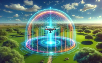
2. Geofencing
Geofencing is another safety measure made possible by GPS technology. It involves creating virtual boundaries in specific geographical areas where drones are not allowed to fly. These no-fly zones may include airports, government buildings, and other restricted areas. GPS data is used to precisely define these boundaries and enable drones to automatically adjust their flight paths to avoid entering restricted airspace.
Geofencing helps prevent accidental drone incursions into sensitive areas and reduces the risk of collisions with manned aircraft, enhancing overall airspace safety.
3. Enhanced Emergency Response
GPS-equipped drones play a crucial role in emergency response scenarios, such as search and rescue missions and disaster assessment. The ability to accurately determine a drone’s location is essential for coordinating efforts with other emergency responders and ensuring that resources are deployed efficiently.
In emergency situations, drones can transmit their GPS coordinates to command centers, enabling rapid deployment and targeted search efforts. This real-time tracking capability can be life-saving, especially in time-sensitive missions.
4. Compliance with Airspace Regulations
GPS technology empowers drone operators to comply with airspace regulations more effectively. By providing precise location data, drones can avoid restricted areas and maintain safe distances from manned aircraft, contributing to overall aviation safety.
Additionally, GPS-based features like altitude hold and Return-to-Home (RTH) assist operators in complying with regulations, ensuring that drones operate within legal limits and return safely to their launch points when necessary.
The integration of GPS technology into drones has led to significant advancements in regulatory compliance and safety measures. Drone Remote Identification, geofencing, and enhanced emergency response capabilities are just a few examples of how GPS has shaped the evolving landscape of drone regulations. As the drone industry continues to grow, GPS technology will remain a critical component in ensuring responsible and secure drone operations, fostering safe coexistence in our increasingly crowded skies.
Navigational Precision:
How GPS Enhances Drone Flight and Functionality
GPS (Global Positioning System) has made drone flying more accurate and sure. It brought in a time of good navigation skills for these machines. In this part, we will look at how GPS helps drones fly and work better. It lets drones do many things very precisely.
- Improved Signal Quality
One big plus of drones with GPS is that they can get messages from satellites circling Earth. This network gives drones a global positioning system that makes sure strong and stable signals always work well, even in tough places. Because of this, drones can stay linked to satellites. That helps them track their location accurately during flights.
- Precise Location Tracking
GPS technology lets drones know their exact position on land and altitude with very good accuracy. This information is very important for many uses like taking pictures from the sky, making maps and checking land. The exact place information lets drones take pictures and data at given map spots, making sure the gathered info is right.
- Autonomous Navigation
Drones with GPS can fly by themselves. This means they know how to follow certain flight paths and spots in the sky without much help from people. People can set up hard missions and flight paths for the drone, then it will follow them carefully. This ability is really useful in jobs that need lots of exact data gathering, like checking farms or looking at buildings.
- Geolocation Accuracy
GPS technology’s ability to accurately find locations helps in tasks like aiming for certain spots. For example, in search and rescue operations, drones can find the exact place of a signal for help or someone who is lost. This high level of precision greatly improves the speed and success of these jobs.
- Real-Time Tracking and Monitoring
Drones with GPS can track and watch in real time. People who control the drone can see where it is, how high up and fast it’s going right now on their far away screens. This information is very important for making sure safe and careful flights, especially when flying in changing areas or during hard jobs.
- Redundancy and Safety
GPS tech also helps with backup and safety steps. Drones with GPS can use features like Home-Return (RTH). These guide the drone back to where it started if there’s a signal problem or low battery. This extra part makes sure drones can always go back to safety. This lowers the chance of accidents or losing important stuff.
- Enhanced Flight Stability
GPS helps airplanes fly better, especially in bad weather or when they have to stay still. The exact place data lets drones make fast changes to their flying path, fixing problems like wind or bumpy air. This balance is very important for jobs like taking pictures in the sky, where clear and steady images are needed.
GPS technology has fundamentally transformed how drones navigate and operate. The advantages of improved signal quality, precise location tracking, autonomous navigation, and real-time monitoring have expanded the scope of drone applications across various industries.
As we continue to explore the impact of drones and GPS on drone technology, it becomes evident that the level of navigational precision it provides is a cornerstone of the drone revolution, opening up new possibilities and ensuring reliable and accurate performance in diverse tasks.
Cost and Accessibility:
Considering the Value of Drones and GPS
GPS technology has clearly made drones better, but we need to think about the price and whether it’s easy for everyone to get these GPS-using drones. As drones become more common and used in different areas, knowing the money effects of GPS on drone tech is very important.
- Initial Investment
Drones with GPS usually cost more than ones without it at first. Adding in GPS hardware and software makes the total cost of a drone higher. But, people usually think it’s worth the money because GPS technology gives more features and abilities.
- Ongoing Costs
When you buy a GPS-equipped drone, there might be extra long term costs like keeping it in good shape. You may also need regular software changes and pay for licenses. These costs should be included in the complete ownership price when thinking about how valuable GPS can be for drones.
- Economic Benefits
Even with the first and ongoing costs, drones that have drones and GPS often give big money advantages. They bring accuracy and speed to many businesses, which can save money and make them more productive. For example:
- In farming, drones with GPS can make crop care better. This helps to grow more crops and use less resources like water and fertilizer.
- In building and road checking, drones can quicken data gathering and lessen the need for costly hand exams.
- In search and rescue operations, the time saved by drones with GPS can be a matter of life or death.
- Accessibility and Adoption
As time goes on and technology gets better, the affordability of GPS-equipped drones has become easier. This easy way of doing things has made more people use it in many different areas and uses.
- Considerations for Different Sectors
It’s important to think about the different needs of various groups when looking at how useful GPS is in drones. Some jobs like mapping and farming need drones and GPS technology a lot. They see it as an important part of their work. On the other hand, people who use drones as a hobby might think about cost and benefit differently.
- Return on Investment (ROI)
Figuring out the money made from drones and GPS needs counting both good and bad things over time. Companies and groups need to balance the first costs against how much money they could save, work faster or make more cash from using GPS tech.
The price and ease of getting GPS technology in drones are important things to think about when looking at their worth. Using GPS-using drones comes with some costs that happen at the start and keep happening. But, the money gains these flying robots give can often make those expenses less important than they seem.
The use of GPS tech in different areas shows its clear worth and how it has changed the drone industry. As drones keep on changing and get involved in our everyday life more, understanding the money side of GPS in drone technology is very important for businesses, people who fly them and fans.
The Future of Drones and GPS Technology:
Trends and Predictions
As technology continues to progress the future of GPS, in drone technology holds potential and promises to further revolutionize the capabilities of unmanned aerial vehicles (UAVs). In this section we will explore some trends and predictions for the future of GPS technology in the drone industry.
1. Enhanced. Accuracy
In the coming years future GPS systems in drones are expected to offer levels of precision and accuracy. This advancement will empower drones to carry out tasks that require delivery of packages detailed environmental monitoring and advanced search and rescue operations.
2. Support for Multiple Satellite Constellations
GPS receivers in drones are likely to support satellite constellations beyond the traditional GPS system. These may include Galileo, GLONASS, BeiDou among others. The inclusion of these constellations will improve signal reliability in urban areas or regions with challenging satellite visibility.
3. Integration of Real Time Data
Drones equipped with GPS systems will have the capability to integrate real time data from sensors and sources. This integration will enable drones to make decisions on the go enhancing their autonomy and adaptability during missions.
4. Impact of 5G Connectivity
The introduction of 5G networks will play a role, in shaping the landscape for GPS equipped drones. The advent of speed 5G connectivity will empower drones to exchange information allowing for real time data transmission remote monitoring, control and collaborative missions. This technological advancement holds significance, for applications such, as drone swarms and autonomous drone operations.
5. AI and Machine Learning Integration
AI and ML algorithms will be more and more incorporated, into GPS enabled drones improving their navigation, obstacle avoidance and mission planning capabilities. This integration will make drones smarter and more efficient, in carrying out their tasks.
6. Urban Air Mobility (UAM)
GPS-enabled drones will play a pivotal role in the emerging field of urban air mobility. These drones will provide aerial transportation solutions for passengers and cargo in urban and suburban areas, reducing congestion on the ground and revolutionizing transportation networks.
7. Environmental Monitoring and Climate Action
Drones equipped with advanced GPS technology will contribute to environmental monitoring and climate action efforts. They will be used to collect data on deforestation, pollution, wildlife conservation, and climate change impacts, providing valuable insights for environmental conservationists and policymakers.
8. Regulatory Evolution
The continued growth of the drone industry will drive regulatory evolution. Governments and aviation authorities will work to establish clear guidelines for the safe and responsible use of GPS-enabled drones, ensuring that they integrate seamlessly into airspace management systems.
9. Security and Privacy Concerns
As the use of GPS-enabled drones expands, so do security and privacy concerns. Future developments in GPS technology will also focus on addressing these issues, with features like encrypted communication and improved data protection measures.
The future of GPS in drone technology promises exciting advancements and transformative possibilities. From higher precision and multi-constellation support to AI integration and urban air mobility, GPS-equipped drones are poised to reshape industries and contribute to a wide range of applications. As the technology continues to evolve, it will be essential for stakeholders to stay informed about these trends and adapt to the changing landscape of GPS-enabled drone technology.
Conclusion
In conclusion the integration of GPS technology, into drone systems has opened up a world of innovation and possibilities. It has greatly improved precision in mapping and agriculture well as revolutionized search and rescue operations.
GPS enabled drones have become tools across industries. The advancements in navigation, stability and safety that GPS technology brings have not expanded the range of drone applications. Have also led to changes in regulations and exciting future developments.
Looking ahead the future of GPS in drone technology is filled with prospects. We can expect precision support for multiple constellations and the integration of AI and 5G connectivity.
These advancements will further enhance the capabilities of drones allowing them to handle tasks and play a role in environmental monitoring and urban air mobility. However along with these opportunities come responsibilities such as addressing security and privacy concerns while adapting frameworks.
In this changing landscape it is crucial for businesses, operators and enthusiasts to stay informed about the trends and fully embrace the potential offered by GPS equipped drones. As GPS technology continues to evolve hand in hand with the drone industry’s growth there are no limits to innovation, in the future.
3 Comments on “Drones and GPS | How GPS Technology is Revolutionizing Drone Flight”